|
Location:
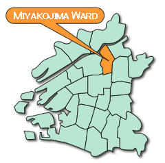
Miyakojima-Ward is located in the northeast of OsakaCity at latitude 34.41, longitude 135.31 (ward office location), is 6.05km2 in area and makes up 2.72% of Osaka's 222 47 km2.
Topography:
It is a riverfront community with the Okawa-river to the west, Yodokawa River in the north, and in the south Neyagawa. On the whole, flat with an average height of 5m above sea level with the highest point (at the Yodokawa River) being 13m.
History:
Miyakojima-Ward was created by the 22 administrative division operation on April 1st, 1943 giving birth to the ward as it exists today.
In times past the land was little more than sand dunes housing reeds but in more recent history the southern parts of the ward has served to connect the land of Namba to the nations of Yamashiro, Kawachi, and Yamato. Furthermore, the central north has developed as a suburban farming community.
The Yodokawa River which flows to the north of the ward has been utilized as the main water passage linking Osaka to Kyoto.
The Yodokawa River has repeatedly flooded throughout history and after the great flood of 1885 improvements were begun. In 1909 New Yodokawa River was forged and in the following year the Arai and Kema dams were constructed playing a large role in the modernization of Osaka.
The Kyobashi area which once served as a hub of traffic at the starting point of the Kyokaido, continues to serve as the entrance hall to eastern Osaka with its connections to JR Osaka Loop Line, Gakken-toshi Line, Touzai Line, Keihan, and Nagahori Tsurumi-rokyuchi Subway Lines. It is also known as a town for commerce.
,
 |
 |
 |
| Official flower |
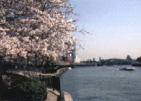
Kema Sakuranomiya Park |
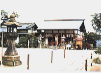
Miyakojima Shinto Shrine |
|